


Seneca Voting District, Loudoun County, Virginia
About
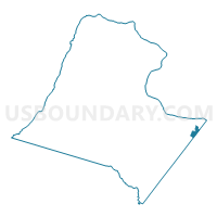
Outline

Summary
| Unique Area Identifier | 682091 |
| Name | Seneca Voting District |
| County | Loudoun County |
| State | Virginia |
| Area (square miles) | 1.11 |
| Land Area (square miles) | 1.10 |
| Water Area (square miles) | 0.01 |
| % of Land Area | 99.25 |
| % of Water Area | 0.75 |
| Latitude of the Internal Point | 39.02849770 |
| Longtitude of the Internal Point | -77.36658620 |
Maps


Graphs
Select a template below for downloading or customizing gragh for Seneca Voting District, Loudoun County, Virginia


Neighbors
Neighoring Voting District (by Name) Neighboring Voting District on the Map
- Clearview Voting District, Fairfax County, VA
- Lowes Island Voting District, Loudoun County, VA
- Mirror Ridge Voting District, Loudoun County, VA
- Rolling Ridge Voting District, Loudoun County, VA
- Seneca Voting District, Fairfax County, VA
- South Bank Voting District, Loudoun County, VA
- Sugarland North Voting District, Loudoun County, VA
- Sugarland South Voting District, Loudoun County, VA
Top 10 Neighboring County Subdivision (by Population) Neighboring County Subdivision on the Map
- Dranesville district, Fairfax County, VA (114,174)
- Sugarland Run district, Loudoun County, VA (26,287)
- Sterling district, Loudoun County, VA (23,846)
Top 10 Neighboring Place (by Population) Neighboring Place on the Map
- Sterling CDP, VA (27,822)
- Great Falls CDP, VA (15,427)
- Dranesville CDP, VA (11,921)
- Cascades CDP, VA (11,912)
- Sugarland Run CDP, VA (11,799)
- Lowes Island CDP, VA (10,756)
Top 10 Neighboring Unified School District (by Population) Neighboring Unified School District on the Map
Top 10 Neighboring State Legislative District Lower Chamber (by Population) Neighboring State Legislative District Lower Chamber on the Map
- State House District 32, VA (112,677)
- State House District 86, VA (89,028)
- State House District 34, VA (74,627)
Top 10 Neighboring State Legislative District Upper Chamber (by Population) Neighboring State Legislative District Upper Chamber on the Map
Top 10 Neighboring 111th Congressional District (by Population) Neighboring 111th Congressional District on the Map
Top 10 Neighboring Census Tract (by Population) Neighboring Census Tract on the Map
- Census Tract 6112.09, Loudoun County, VA (6,503)
- Census Tract 4804.02, Fairfax County, VA (5,936)
- Census Tract 6113, Loudoun County, VA (5,913)
- Census Tract 4805.02, Fairfax County, VA (5,784)
- Census Tract 6112.05, Loudoun County, VA (5,774)
- Census Tract 6112.04, Loudoun County, VA (5,503)
- Census Tract 6112.02, Loudoun County, VA (4,744)
- Census Tract 6112.08, Loudoun County, VA (4,253)